
Thank you for supporting this site ❤️
Make a donation
Make a donation
Gear up for your next adventure:
As an Amazon Associate, this site earns from qualifying purchases at no extra cost to you.
Tablat topographic map
Click on the map to display elevation.
Thank you for supporting this site ❤️
Make a donation
Make a donation
Gear up for your next adventure:
As an Amazon Associate, this site earns from qualifying purchases at no extra cost to you.
About this map
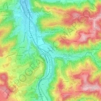
Name: Tablat topographic map, elevation, terrain.
Location: Tablat, Turbenthal, Bezirk Winterthur, Zürich, 8492, Schweiz (47.39176 8.83983 47.43176 8.87983)
Average elevation: 2,221 ft
Minimum elevation: 1,814 ft
Maximum elevation: 2,700 ft
Thank you for supporting this site ❤️
Make a donation
Make a donation
Gear up for your next adventure:
As an Amazon Associate, this site earns from qualifying purchases at no extra cost to you.