
Thank you for supporting this site ❤️
Make a donation
Make a donation
Gear up for your next adventure:
As an Amazon Associate, this site earns from qualifying purchases at no extra cost to you.
Cisitu topographic map
Click on the map to display elevation.
Thank you for supporting this site ❤️
Make a donation
Make a donation
Gear up for your next adventure:
As an Amazon Associate, this site earns from qualifying purchases at no extra cost to you.
About this map
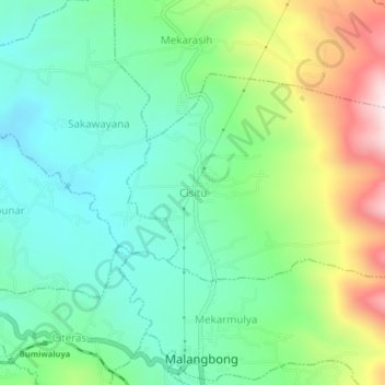
Name: Cisitu topographic map, elevation, terrain.
Location: Cisitu, Malangbong, Garut, West Java, Java, Indonesia (-7.06305 108.06613 -7.02305 108.10613)
Average elevation: 2,188 ft
Minimum elevation: 1,640 ft
Maximum elevation: 3,373 ft
Thank you for supporting this site ❤️
Make a donation
Make a donation
Gear up for your next adventure:
As an Amazon Associate, this site earns from qualifying purchases at no extra cost to you.