
Thank you for supporting this site ❤️
Make a donation
Make a donation
Gear up for your next adventure:
As an Amazon Associate, this site earns from qualifying purchases at no extra cost to you.
Torphichen topographic map
Click on the map to display elevation.
Thank you for supporting this site ❤️
Make a donation
Make a donation
Gear up for your next adventure:
As an Amazon Associate, this site earns from qualifying purchases at no extra cost to you.
About this map
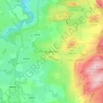
Name: Torphichen topographic map, elevation, terrain.
Location: Torphichen, West Lothian, Scotland, EH48 4LY, United Kingdom (55.91350 -3.67420 55.95350 -3.63420)
Average elevation: 531 ft
Minimum elevation: 236 ft
Maximum elevation: 1,020 ft
Thank you for supporting this site ❤️
Make a donation
Make a donation
Gear up for your next adventure:
As an Amazon Associate, this site earns from qualifying purchases at no extra cost to you.