
Thank you for supporting this site ❤️
Make a donation
Make a donation
Gear up for your next adventure:
As an Amazon Associate, this site earns from qualifying purchases at no extra cost to you.
Patarata topographic map
Click on the map to display elevation.
Thank you for supporting this site ❤️
Make a donation
Make a donation
Gear up for your next adventure:
As an Amazon Associate, this site earns from qualifying purchases at no extra cost to you.
About this map
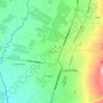
Name: Patarata topographic map, elevation, terrain.
Location: Patarata, Cayambe, Pichincha, 171002, Ecuador (0.02827 -78.16995 0.06827 -78.12995)
Average elevation: 9,216 ft
Minimum elevation: 8,914 ft
Maximum elevation: 9,797 ft
Thank you for supporting this site ❤️
Make a donation
Make a donation
Gear up for your next adventure:
As an Amazon Associate, this site earns from qualifying purchases at no extra cost to you.