
Thank you for supporting this site ❤️
Make a donation
Make a donation
Gear up for your next adventure:
As an Amazon Associate, this site earns from qualifying purchases at no extra cost to you.
Buda topographic map
Click on the map to display elevation.
Thank you for supporting this site ❤️
Make a donation
Make a donation
Gear up for your next adventure:
As an Amazon Associate, this site earns from qualifying purchases at no extra cost to you.
About this map
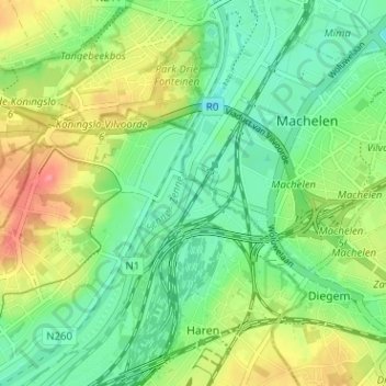
Name: Buda topographic map, elevation, terrain.
Location: Buda, Haren, Bruxelles, Bruxelles-Capitale, 1831, Belgique (50.88519 4.39415 50.92519 4.43415)
Average elevation: 92 ft
Minimum elevation: -7 ft
Maximum elevation: 246 ft
Thank you for supporting this site ❤️
Make a donation
Make a donation
Gear up for your next adventure:
As an Amazon Associate, this site earns from qualifying purchases at no extra cost to you.