Geolocate

Vapar topographic map

Click on the map to display elevation.

About this map

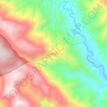
Name: Vapar topographic map, elevation, terrain.

Location: Vapar, Champhai, India (23.59950 93.32963 23.63950 93.36963)

Average elevation: 4,327 ft

Minimum elevation: 3,097 ft

Maximum elevation: 5,604 ft

Gear up for your next adventure:

🔊Portable Camp Speaker - Music and alerts at camp
🥾Hiking Shoes - Durable and comfortable shoes for trail hiking
🦶Hiking Gaiters - Keep debris and water out of your boots
❄️Traction Cleats - Prevent slips on icy trails during winter hikes
🎒Waterproof Dry Bags - Keep your electronics and maps dry inside your pack

As an Amazon Associate, this site earns from qualifying purchases at no extra cost to you.