
Thank you for supporting this site ❤️
Make a donation
Make a donation
Gear up for your next adventure:
As an Amazon Associate, this site earns from qualifying purchases at no extra cost to you.
Miguir topographic map
Click on the map to display elevation.
Thank you for supporting this site ❤️
Make a donation
Make a donation
Gear up for your next adventure:
As an Amazon Associate, this site earns from qualifying purchases at no extra cost to you.
About this map
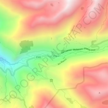
Name: Miguir topographic map, elevation, terrain.
Location: Miguir, Molleturo, Cuenca, Azuay, Ecuador (-2.82207 -79.32376 -2.78207 -79.28376)
Average elevation: 12,559 ft
Minimum elevation: 10,243 ft
Maximum elevation: 14,393 ft
Thank you for supporting this site ❤️
Make a donation
Make a donation
Gear up for your next adventure:
As an Amazon Associate, this site earns from qualifying purchases at no extra cost to you.