Geolocate

Watlar topographic map

Click on the map to display elevation.

About this map

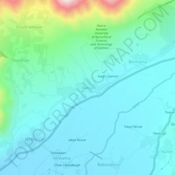
Name: Watlar topographic map, elevation, terrain.

Location: Watlar, Lar, Ganderbal, Jammu and Kashmir, 191201, India (34.24873 74.75070 34.28873 74.79070)

Average elevation: 5,659 ft

Minimum elevation: 5,246 ft

Maximum elevation: 7,579 ft

Gear up for your next adventure:

🧢Outdoor Hiking Hat - Sun protection hat for outdoor explorers
👟Trail Running Shoes - Lightweight shoes for trail runners
🍳Camping Cook Set - Complete cookware for outdoor meals
👖Convertible Hiking Pants - Versatile zip-off pants for changing altitudes and temperatures
👟Men's Trail Runners - Lightweight footwear for fast-paced exploration and light hiking

As an Amazon Associate, this site earns from qualifying purchases at no extra cost to you.