
Make a donation
Gear up for your next adventure:
As an Amazon Associate, this site earns from qualifying purchases at no extra cost to you.
Bonheiden topographic map
Click on the map to display elevation.
Make a donation
Gear up for your next adventure:
As an Amazon Associate, this site earns from qualifying purchases at no extra cost to you.
Bonheiden
In 1578 versloegen de Staatsen in het gehucht Mispeldonk, tussen Bonheiden en Rijmenam, de Spanjaarden in de Slag van Rijmenam. In 1939-1940 bouwde men in Bonheiden een bunker ter hoogte van de Muizenhoekstraat, de TPM 21. De bunker was een onderdeel van de KW-stelling.
Make a donation
Gear up for your next adventure:
As an Amazon Associate, this site earns from qualifying purchases at no extra cost to you.
About this map
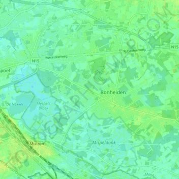
Name: Bonheiden topographic map, elevation, terrain.
Location: Bonheiden, Mechelen, Antwerpen, Vlaanderen, 2820, België (51.00513 4.50282 51.04687 4.58271)
Average elevation: 20 ft
Minimum elevation: 0 ft
Maximum elevation: 39 ft
Make a donation
Gear up for your next adventure:
As an Amazon Associate, this site earns from qualifying purchases at no extra cost to you.