
Tilford topographic map
Click on the map to display elevation.
About this map
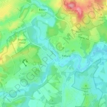
Name: Tilford topographic map, elevation, terrain.
Location: Tilford, Waverley, Surrey, England, United Kingdom (51.16531 -0.78160 51.20894 -0.72331)
Average elevation: 246 ft
Minimum elevation: 148 ft
Maximum elevation: 509 ft