Geolocate

Calhoun topographic map

Click on the map to display elevation.

About this map

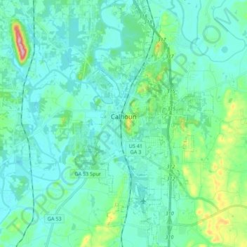
Name: Calhoun topographic map, elevation, terrain.

Location: Calhoun, Gordon County, Georgia, 30701, United States (34.42973 -84.98116 34.56758 -84.89026)

Average elevation: 689 ft

Minimum elevation: 594 ft

Maximum elevation: 1,165 ft

Gordon County trails, hiking, mountain biking, running and outdoor activities

Other topographic maps

Click on a map to view its topography, its elevation and its terrain.

Sugar Valley

United States > Georgia > Gordon County

Average elevation: 682 ft

Bobo

United States > Georgia > Gordon County

Average elevation: 912 ft

Gear up for your next adventure:

🧤Tactile Hiking Gloves - Keep hands warm while operating GPS and smartphone screens
💧Water Purification System - Clean water on the trail with reliable purifiers
👟Trail Running Shoes - Lightweight shoes for trail runners
Camping Coffee Makers - Enjoy premium coffee at the summit or campsite
🔦LED Headlamp - Bright and durable LED headlamp for night navigation

As an Amazon Associate, this site earns from qualifying purchases at no extra cost to you.