Geolocate

Riverton topographic map

Click on the map to display elevation.

About this map

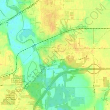
Name: Riverton topographic map, elevation, terrain.

Location: Riverton, Sangamon County, Illinois, 62651, United States (39.82239 -89.55867 39.86356 -89.51582)

Average elevation: 561 ft

Minimum elevation: 509 ft

Maximum elevation: 600 ft

Sangamon County trails, hiking, mountain biking, running and outdoor activities

Other topographic maps

Click on a map to view its topography, its elevation and its terrain.

Bates

United States > Illinois > Sangamon County

Average elevation: 636 ft

Farmingdale

United States > Illinois > Sangamon County

Average elevation: 591 ft

Gear up for your next adventure:

🧴Hand Sanitizer - Keep hands clean while hiking
🧢Outdoor Hiking Hat - Sun protection hat for outdoor explorers
🔭Stargazing Telescopes - Perfect for camping in low-light pollution areas shown on maps
💧Water Purification System - Clean water on the trail with reliable purifiers
🔦Powerful Headlamps - Ultra-bright hands-free lighting for night navigation

As an Amazon Associate, this site earns from qualifying purchases at no extra cost to you.