
San Estanislao topographic map
Interactive map
Click on the map to display elevation.
About this map
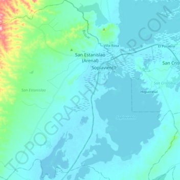
Name: San Estanislao topographic map, elevation, terrain.
Location: San Estanislao, Dique, Bolívar, RAP Caribe, Colombie (10.27959 -75.29039 10.45532 -75.12832)
Average elevation: 95 ft
Minimum elevation: -10 ft
Maximum elevation: 919 ft
Other topographic maps
Click on a map to view its topography, its elevation and its terrain.
San Juan Nepomuceno
San Juan Nepomuceno, Bolívar, Colombie
Average elevation: 495 ft