Geolocate

Biesenberg topographic map

Click on the map to display elevation.

Biesenberg

Der Ortsname setzt sich aus dem Personennamen Buoso und dem Grundwort -berg zusammen. Somit bedeutet der Ortsname (Siedlung an der) Anhöhe des Buoso.

Wikipedia (CC-BY-SA 3.0)

About this map

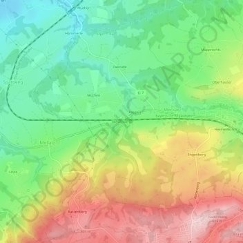
Name: Biesenberg topographic map, elevation, terrain.

Location: Biesenberg, Meckatz, Heimenkirch, Landkreis Lindau, Bayern, 88161, Deutschland (47.60948 9.85653 47.64948 9.89653)

Average elevation: 2,208 ft

Minimum elevation: 1,844 ft

Maximum elevation: 2,694 ft

Gear up for your next adventure:

📷Action Camera - Capture your outdoor adventures in HD
🪶LED Camping Lantern - Bright lantern for camp lighting
💧Water Filtration Bottles - Safely drink from streams and lakes while exploring
🧥Waterproof Jacket for Hiking - Breathable and rugged rain jacket for outdoor excursions
👓Polarized Sunglasses - Outdoor sunglasses for glare reduction

As an Amazon Associate, this site earns from qualifying purchases at no extra cost to you.