
Thank you for supporting this site ❤️
Make a donation
Make a donation
Gear up for your next adventure:
As an Amazon Associate, this site earns from qualifying purchases at no extra cost to you.
Praglie topographic map
Click on the map to display elevation.
Thank you for supporting this site ❤️
Make a donation
Make a donation
Gear up for your next adventure:
As an Amazon Associate, this site earns from qualifying purchases at no extra cost to you.
About this map
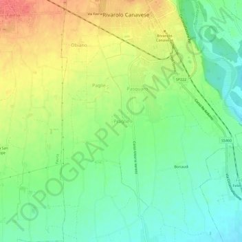
Name: Praglie topographic map, elevation, terrain.
Location: Praglie, Rivarolo Canavese, Torino, Piemont, 10086, Italy (45.29360 7.69603 45.33360 7.73603)
Average elevation: 951 ft
Minimum elevation: 866 ft
Maximum elevation: 1,066 ft
Thank you for supporting this site ❤️
Make a donation
Make a donation
Gear up for your next adventure:
As an Amazon Associate, this site earns from qualifying purchases at no extra cost to you.