Geolocate

Mehrauli topographic map

Click on the map to display elevation.

About this map

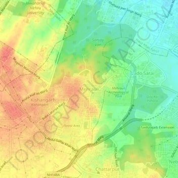
Name: Mehrauli topographic map, elevation, terrain.

Location: Mehrauli, Mehrauli Tehsil, South Delhi, Delhi, 110030, India (28.50183 77.15832 28.54183 77.19832)

Average elevation: 830 ft

Minimum elevation: 741 ft

Maximum elevation: 912 ft

Gear up for your next adventure:

GPS Sports Watch - GPS watch for running, hiking and training
🖼️Topo Map Wall Art - Decorative topographic prints of famous peaks and regions
🧢Outdoor Hiking Hat - Sun protection hat for outdoor explorers
📦Dry Bags Set - Waterproof storage for electronics and clothes
📷Action Cameras - Rugged cameras to document your journeys across rugged terrain

As an Amazon Associate, this site earns from qualifying purchases at no extra cost to you.