Geolocate

Phippsburg topographic map

Click on the map to display elevation.

About this map

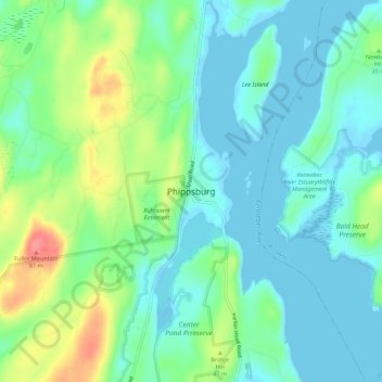
Name: Phippsburg topographic map, elevation, terrain.

Location: Phippsburg, Sagadahoc County, Maine, 04562, United States (43.80064 -69.83477 43.84064 -69.79477)

Average elevation: 75 ft

Minimum elevation: -10 ft

Maximum elevation: 262 ft

Maine trails, hiking, mountain biking, running and outdoor activities

Gear up for your next adventure:

🦶Hiking Gaiters - Keep debris and water out of your boots
🛡️Insect Repellent - Protection against bugs during outdoor activities
🖼️Topo Map Wall Art - Decorative topographic prints of famous peaks and regions
📷Action Cameras - Rugged cameras to document your journeys across rugged terrain
🦟Ultrasonic Repellers - Create a bug-free zone at your camp or rest stop

As an Amazon Associate, this site earns from qualifying purchases at no extra cost to you.