
Thank you for supporting this site ❤️
Make a donation
Make a donation
Gear up for your next adventure:
As an Amazon Associate, this site earns from qualifying purchases at no extra cost to you.
Casual topographic map
Click on the map to display elevation.
Thank you for supporting this site ❤️
Make a donation
Make a donation
Gear up for your next adventure:
As an Amazon Associate, this site earns from qualifying purchases at no extra cost to you.
About this map
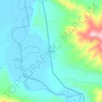
Name: Casual topographic map, elevation, terrain.
Location: Casual, Bagua, Province of Bagua, Amazonas, Peru (-5.60924 -78.57256 -5.56924 -78.53256)
Average elevation: 1,444 ft
Minimum elevation: 1,204 ft
Maximum elevation: 2,392 ft
Thank you for supporting this site ❤️
Make a donation
Make a donation
Gear up for your next adventure:
As an Amazon Associate, this site earns from qualifying purchases at no extra cost to you.