
Mexia topographic map
Click on the map to display elevation.
About this map
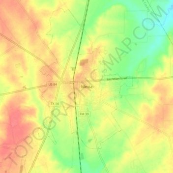
Name: Mexia topographic map, elevation, terrain.
Location: Mexia, Limestone County, Texas, 76667, United States (31.64162 -96.51837 31.72162 -96.43837)
Average elevation: 505 ft
Minimum elevation: 400 ft
Maximum elevation: 584 ft
Limestone County trails, hiking, mountain biking, running and outdoor activities