
Make a donation
Gear up for your next adventure:
As an Amazon Associate, this site earns from qualifying purchases at no extra cost to you.
Parque Nacional Podocarpus topographic map
Click on the map to display elevation.
Make a donation
Gear up for your next adventure:
As an Amazon Associate, this site earns from qualifying purchases at no extra cost to you.
Parque Nacional Podocarpus
The Podocarpus National Park spans from lower montane rain forests at about 1,000 metres (3,300 ft) elevation, up to high elevation elfin forests at 3,000 metres (9,800 ft). Paramo or subparamo vegetation is found at elevations above 3,000 m (9,800 ft) where a complex of more than 100 lagoons exists, among the best-known being the Lagunas del Compadre.
Make a donation
Gear up for your next adventure:
As an Amazon Associate, this site earns from qualifying purchases at no extra cost to you.
About this map
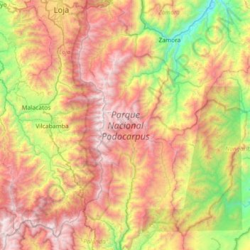
Name: Parque Nacional Podocarpus topographic map, elevation, terrain.
Average elevation: 7,067 ft
Minimum elevation: 2,776 ft
Maximum elevation: 12,241 ft
Make a donation
Gear up for your next adventure:
As an Amazon Associate, this site earns from qualifying purchases at no extra cost to you.