
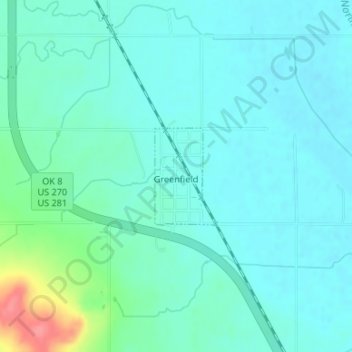
Greenfield topographic map
Interactive map
Click on the map to display elevation.
About this map
Name: Greenfield topographic map, elevation, terrain.
Location: Greenfield, Blaine County, Oklahoma, United States (35.72512 -98.37985 35.73257 -98.37416)
Average elevation: 1,483 ft
Minimum elevation: 1,434 ft
Maximum elevation: 1,683 ft
Other topographic maps
Click on a map to view its topography, its elevation and its terrain.
Geary
United States > Oklahoma > Blaine County
Geary, Blaine County, Oklahoma, 73040, United States
Average elevation: 1,506 ft
Okeene
United States > Oklahoma > Blaine County
Okeene, Blaine County, Oklahoma, 73763, United States
Average elevation: 1,211 ft
Canton Lake
United States > Oklahoma > Blaine County
Canton Lake, Blaine County, Oklahoma, United States
Average elevation: 1,647 ft
Watonga
United States > Oklahoma > Blaine County
Watonga, Blaine County, Oklahoma, 73772, United States
Average elevation: 1,532 ft