
Make a donation
Gear up for your next adventure:
As an Amazon Associate, this site earns from qualifying purchases at no extra cost to you.
Fritch topographic map
Click on the map to display elevation.
Make a donation
Gear up for your next adventure:
As an Amazon Associate, this site earns from qualifying purchases at no extra cost to you.
Fritch
Fritch is primarily a bedroom community, with the majority of citizens commuting to nearby Borger and Amarillo for work. Major employers in the area include Pantex, ConocoPhillips, and Agrium, all located within a short distance of Fritch. Due to its nature as a commuting town, Fritch differs from most small towns in the region, which rely more on agriculture as their economic base. Though several large ranches are adjacent to the town, little to no farming occurs due to the uneven topography, and the town has few agriculture-related services.
Make a donation
Gear up for your next adventure:
As an Amazon Associate, this site earns from qualifying purchases at no extra cost to you.
About this map
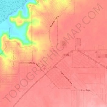
Name: Fritch topographic map, elevation, terrain.
Location: Fritch, Hutchinson County, Texas, United States (35.63090 -101.62344 35.65886 -101.57331)
Average elevation: 3,166 ft
Minimum elevation: 2,897 ft
Maximum elevation: 3,241 ft
Hutchinson County trails, hiking, mountain biking, running and outdoor activities
Make a donation
Gear up for your next adventure:
As an Amazon Associate, this site earns from qualifying purchases at no extra cost to you.
Other topographic maps
Click on a map to view its topography, its elevation and its terrain.