
Thank you for supporting this site ❤️
Make a donation
Make a donation
Gear up for your next adventure:
As an Amazon Associate, this site earns from qualifying purchases at no extra cost to you.
Rajputwadi topographic map
Click on the map to display elevation.
Thank you for supporting this site ❤️
Make a donation
Make a donation
Gear up for your next adventure:
As an Amazon Associate, this site earns from qualifying purchases at no extra cost to you.
About this map
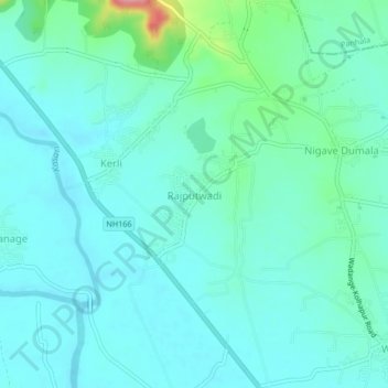
Name: Rajputwadi topographic map, elevation, terrain.
Location: Rajputwadi, Karvir, Kolhapur, Maharashtra, 416229, India (16.72603 74.17127 16.76603 74.21127)
Average elevation: 1,827 ft
Minimum elevation: 1,762 ft
Maximum elevation: 2,133 ft
Thank you for supporting this site ❤️
Make a donation
Make a donation
Gear up for your next adventure:
As an Amazon Associate, this site earns from qualifying purchases at no extra cost to you.
Other topographic maps
Click on a map to view its topography, its elevation and its terrain.