Geolocate

Salong topographic map

Click on the map to display elevation.

About this map

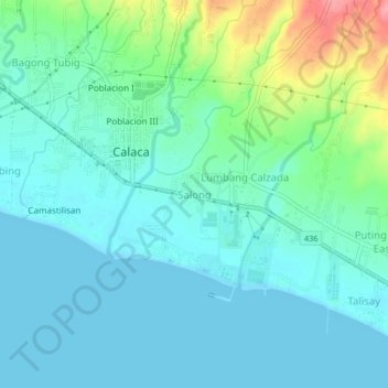
Name: Salong topographic map, elevation, terrain.

Location: Salong, Calaca, Batangas, Calabarzon, 4212, Philippines (13.90598 120.79983 13.94598 120.83983)

Average elevation: 72 ft

Minimum elevation: 0 ft

Maximum elevation: 335 ft

Gear up for your next adventure:

Camping Coffee Makers - Enjoy premium coffee at the summit or campsite
📦Gear Storage Bags - Organize and protect outdoor equipment
🥩Freeze-Dried Meals - Nutritious and lightweight food for remote expeditions
🧥Men's Rain Shells - Premium waterproof and breathable jackets for mountain weather
🛠️Outdoor Gear Repair Kit - Essential tools to fix gear on the trail

As an Amazon Associate, this site earns from qualifying purchases at no extra cost to you.