
Thank you for supporting this site ❤️
Make a donation
Make a donation
Gear up for your next adventure:
As an Amazon Associate, this site earns from qualifying purchases at no extra cost to you.
Xonotzintla topographic map
Click on the map to display elevation.
Thank you for supporting this site ❤️
Make a donation
Make a donation
Gear up for your next adventure:
As an Amazon Associate, this site earns from qualifying purchases at no extra cost to you.
About this map
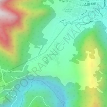
Name: Xonotzintla topographic map, elevation, terrain.
Location: Xonotzintla, Chocamán, Veracruz, 94160, México (18.99517 -97.04589 19.00144 -97.04065)
Average elevation: 4,892 ft
Minimum elevation: 4,065 ft
Maximum elevation: 6,503 ft
Thank you for supporting this site ❤️
Make a donation
Make a donation
Gear up for your next adventure:
As an Amazon Associate, this site earns from qualifying purchases at no extra cost to you.