Geolocate

Rajang topographic map

Click on the map to display elevation.

About this map

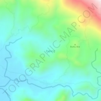
Name: Rajang topographic map, elevation, terrain.

Location: Rajang, Pinrang, South Sulawesi, Sulawesi, Indonesia (-3.57807 119.59858 -3.53807 119.63858)

Average elevation: 709 ft

Minimum elevation: 75 ft

Maximum elevation: 2,697 ft

Other topographic maps

Click on a map to view its topography, its elevation and its terrain.

Gear up for your next adventure:

🧣Merino Neck Gaiters - Multi-functional headwear for wind and sun protection
🦺Reflective Outdoor Gear - Safety gear for low‑light conditions
📡GPS Antenna Upgrade - Enhance GPS reception in remote terrain
🏫Relief Map Kits - Hands-on tools for teaching landforms and elevation
🛡️Insect Repellent - Protection against bugs during outdoor activities

As an Amazon Associate, this site earns from qualifying purchases at no extra cost to you.