Geolocate

Chimba topographic map

Click on the map to display elevation.

About this map

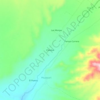
Name: Chimba topographic map, elevation, terrain.

Location: Chimba, Huayuri, Santa Cruz, Province of Palpa, Ica, Peru (-14.54619 -75.30521 -14.50619 -75.26521)

Average elevation: 1,558 ft

Minimum elevation: 1,296 ft

Maximum elevation: 2,119 ft

Gear up for your next adventure:

🧺Microfiber Travel Towels - Compact and fast-drying towels for trail use
🪑Portable Camp Table - Compact table for campsite meals
📦Gear Storage Bags - Organize and protect outdoor equipment
🔥Plasma Lighters - Windproof lighters that work in any weather condition
🛏️Cold Weather Sleeping Bag - Warm sleeping bag for cold conditions

As an Amazon Associate, this site earns from qualifying purchases at no extra cost to you.