Geolocate

Perla topographic map

Click on the map to display elevation.

About this map

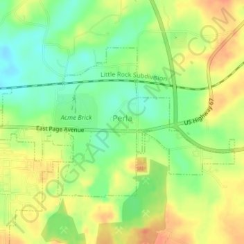
Name: Perla topographic map, elevation, terrain.

Location: Perla, Hot Spring County, Arkansas, 72104, United States (34.35707 -92.79098 34.37359 -92.75858)

Average elevation: 354 ft

Minimum elevation: 279 ft

Maximum elevation: 423 ft

Hot Spring County trails, hiking, mountain biking, running and outdoor activities

Other topographic maps

Click on a map to view its topography, its elevation and its terrain.

Saginaw

United States > Arkansas > Hot Spring County

Average elevation: 305 ft

Bonnerdale

United States > Arkansas > Hot Spring County

Average elevation: 663 ft

Glen Rose

United States > Arkansas > Hot Spring County

Average elevation: 351 ft

Perla

United States > Arkansas > Hot Spring County > Perla

Average elevation: 358 ft

Lono

United States > Arkansas > Hot Spring County

Average elevation: 463 ft

Gear up for your next adventure:

🏔️Mountain Trail Maps - High‑detail maps for popular peaks
GPS Sports Watch - GPS watch for running, hiking and training
🧢Sun Protection Hats - Wide-brimmed and UPF-rated hats for high-altitude sun safety
😴Insulated Sleeping Pads - Compact and warm pads for high-elevation camping
🦶Carbon Trekking Poles - Reduce knee impact on steep descents with ultra-light poles

As an Amazon Associate, this site earns from qualifying purchases at no extra cost to you.