
Thank you for supporting this site ❤️
Make a donation
Make a donation
Gear up for your next adventure:
As an Amazon Associate, this site earns from qualifying purchases at no extra cost to you.
Panecillo topographic map
Click on the map to display elevation.
Thank you for supporting this site ❤️
Make a donation
Make a donation
Gear up for your next adventure:
As an Amazon Associate, this site earns from qualifying purchases at no extra cost to you.
About this map
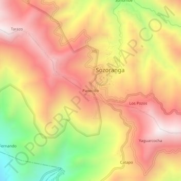
Name: Panecillo topographic map, elevation, terrain.
Location: Panecillo, Sozoranga, Loja, 110703, Ecuador (-4.35148 -79.81466 -4.31148 -79.77466)
Average elevation: 4,774 ft
Minimum elevation: 2,713 ft
Maximum elevation: 6,198 ft
Thank you for supporting this site ❤️
Make a donation
Make a donation
Gear up for your next adventure:
As an Amazon Associate, this site earns from qualifying purchases at no extra cost to you.