
Town of Byron topographic map
Interactive map
Click on the map to display elevation.
About this map
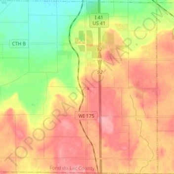
Name: Town of Byron topographic map, elevation, terrain.
Location: Town of Byron, Fond du Lac County, Wisconsin, United States (43.63089 -88.52315 43.71960 -88.40111)
Average elevation: 997 ft
Minimum elevation: 817 ft
Maximum elevation: 1,155 ft
Fond du Lac County trails, hiking, mountain biking, running and outdoor activities
Other topographic maps
Click on a map to view its topography, its elevation and its terrain.