
Thank you for supporting this site ❤️
Make a donation
Make a donation
Gear up for your next adventure:
As an Amazon Associate, this site earns from qualifying purchases at no extra cost to you.
Lossy topographic map
Click on the map to display elevation.
Thank you for supporting this site ❤️
Make a donation
Make a donation
Gear up for your next adventure:
As an Amazon Associate, this site earns from qualifying purchases at no extra cost to you.
About this map
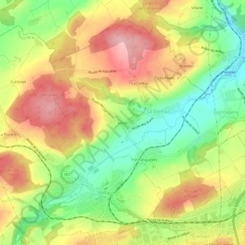
Name: Lossy topographic map, elevation, terrain.
Location: Lossy, La Sonnaz, District de la Sarine, Fribourg, 1782, Suisse (46.81306 7.09075 46.85306 7.13075)
Average elevation: 2,037 ft
Minimum elevation: 1,762 ft
Maximum elevation: 2,310 ft
Thank you for supporting this site ❤️
Make a donation
Make a donation
Gear up for your next adventure:
As an Amazon Associate, this site earns from qualifying purchases at no extra cost to you.