
Thank you for supporting this site ❤️
Make a donation
Make a donation
Gear up for your next adventure:
As an Amazon Associate, this site earns from qualifying purchases at no extra cost to you.
Avelelas topographic map
Click on the map to display elevation.
Thank you for supporting this site ❤️
Make a donation
Make a donation
Gear up for your next adventure:
As an Amazon Associate, this site earns from qualifying purchases at no extra cost to you.
About this map
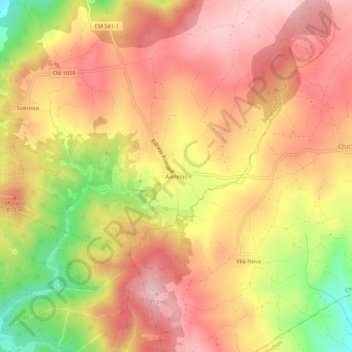
Name: Avelelas topographic map, elevation, terrain.
Location: Avelelas, Águas Frias, Chaves, Vila Real, 5400-603, Portugal (41.71858 -7.38543 41.75858 -7.34543)
Average elevation: 2,516 ft
Minimum elevation: 2,014 ft
Maximum elevation: 2,822 ft
Thank you for supporting this site ❤️
Make a donation
Make a donation
Gear up for your next adventure:
As an Amazon Associate, this site earns from qualifying purchases at no extra cost to you.