
Hudson Bay Mountain topographic map
Interactive map
Click on the map to display elevation.
About this map
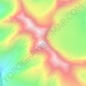
Name: Hudson Bay Mountain topographic map, elevation, terrain.
Average elevation: 6,772 ft
Minimum elevation: 4,951 ft
Maximum elevation: 8,392 ft
Other topographic maps
Click on a map to view its topography, its elevation and its terrain.
Telkwa Range
Canada > British Columbia > Regional District of Bulkley-Nechako > Area A (Hudson Bay Mountain)
Telkwa Range, Area A (Hudson Bay Mountain), Regional District of Bulkley-Nechako, British Columbia, Canada
Average elevation: 6,178 ft