
Thank you for supporting this site ❤️
Make a donation
Make a donation
Gear up for your next adventure:
As an Amazon Associate, this site earns from qualifying purchases at no extra cost to you.
Uitbergen topographic map
Click on the map to display elevation.
Thank you for supporting this site ❤️
Make a donation
Make a donation
Gear up for your next adventure:
As an Amazon Associate, this site earns from qualifying purchases at no extra cost to you.
About this map
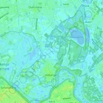
Name: Uitbergen topographic map, elevation, terrain.
Location: Uitbergen, Berlare, Dendermonde, East Flanders, Belgium (51.00620 3.93095 51.04949 3.98507)
Average elevation: 10 ft
Minimum elevation: -16 ft
Maximum elevation: 43 ft
Thank you for supporting this site ❤️
Make a donation
Make a donation
Gear up for your next adventure:
As an Amazon Associate, this site earns from qualifying purchases at no extra cost to you.