
Thank you for supporting this site ❤️
Make a donation
Make a donation
Gear up for your next adventure:
As an Amazon Associate, this site earns from qualifying purchases at no extra cost to you.
Moiben topographic map
Click on the map to display elevation.
Thank you for supporting this site ❤️
Make a donation
Make a donation
Gear up for your next adventure:
As an Amazon Associate, this site earns from qualifying purchases at no extra cost to you.
About this map
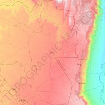
Name: Moiben topographic map, elevation, terrain.
Location: Moiben, Uasin Gishu County, Rift Valley, 30100, Kenya (0.49982 35.25249 0.94350 35.50751)
Average elevation: 6,562 ft
Minimum elevation: 3,396 ft
Maximum elevation: 8,970 ft
Thank you for supporting this site ❤️
Make a donation
Make a donation
Gear up for your next adventure:
As an Amazon Associate, this site earns from qualifying purchases at no extra cost to you.