Geolocate

Pinewood topographic map

Click on the map to display elevation.

About this map

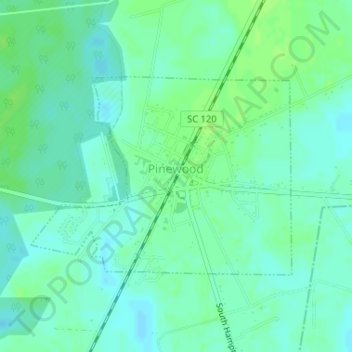
Name: Pinewood topographic map, elevation, terrain.

Location: Pinewood, Sumter County, South Carolina, United States (33.73226 -80.47682 33.74749 -80.45271)

Average elevation: 187 ft

Minimum elevation: 171 ft

Maximum elevation: 207 ft

Sumter County trails, hiking, mountain biking, running and outdoor activities

Other topographic maps

Click on a map to view its topography, its elevation and its terrain.

Wedgefield

United States > South Carolina > Sumter County

Average elevation: 236 ft

Gear up for your next adventure:

📌Outdoor GPS Map App - Apps and devices for digital topographic navigation
🥤Water Filter Bottle - All‑in‑one filter bottle for safe hydration
🚪Portable Camp Chair - Foldable chair for comfort at camp
🎁Geography Themed Gifts - Unique gift ideas for map lovers and geography enthusiasts
📻Weather Alert Radios - Stay informed of storm risks while off-the-grid

As an Amazon Associate, this site earns from qualifying purchases at no extra cost to you.