Geolocate

Waimanalo topographic map

Click on the map to display elevation.

About this map

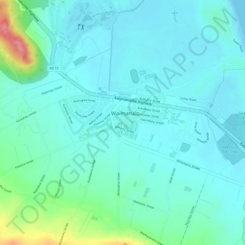
Name: Waimanalo topographic map, elevation, terrain.

Location: Waimanalo, Honolulu County, Hawaii, United States (21.34186 -157.73202 21.34869 -157.71077)

Average elevation: 72 ft

Minimum elevation: 0 ft

Maximum elevation: 351 ft

Honolulu County trails, hiking, mountain biking, running and outdoor activities

Gear up for your next adventure:

🧣Merino Neck Gaiters - Multi-functional headwear for wind and sun protection
🦟Ultrasonic Repellers - Create a bug-free zone at your camp or rest stop
☀️Outdoor Sunscreen - High protection sunscreen for outdoor activities
🧤Hiking Gloves - Protective gloves for rugged trails
🚗GPS Dash Cams - Record your scenic drives through mountain passes and canyons

As an Amazon Associate, this site earns from qualifying purchases at no extra cost to you.