Geolocate

Monroe topographic map

Click on the map to display elevation.

About this map

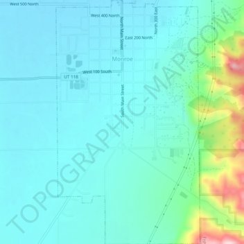
Name: Monroe topographic map, elevation, terrain.

Location: Monroe, Sevier County, Utah, 84754, United States (38.60360 -112.13442 38.64115 -112.10604)

Average elevation: 5,505 ft

Minimum elevation: 5,335 ft

Maximum elevation: 6,339 ft

Sevier County trails, hiking, mountain biking, running and outdoor activities

Gear up for your next adventure:

🌡️Handheld Weather Meters - Measure wind, temp, and pressure for safe mountain travel
🧦Merino Wool Socks - Moisture-wicking, blister-preventing socks for long treks
🪶Survival Guide Book - Expert advice for emergency preparedness
🛠️Outdoor Gear Repair Kit - Essential tools to fix gear on the trail
🪵Folding Camp Saw - Compact saw for wood and campsite work

As an Amazon Associate, this site earns from qualifying purchases at no extra cost to you.