Geolocate

Babai topographic map

Click on the map to display elevation.

About this map

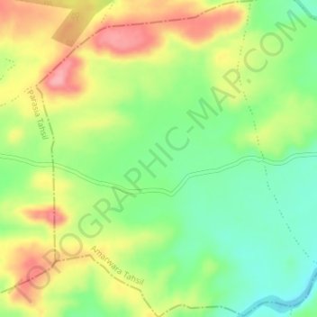
Name: Babai topographic map, elevation, terrain.

Location: Babai, Amarwara Tahsil, Chhindwara, Madhya Pradesh, India (22.18470 78.93981 22.21538 78.96996)

Average elevation: 2,280 ft

Minimum elevation: 2,110 ft

Maximum elevation: 2,487 ft

Other topographic maps

Click on a map to view its topography, its elevation and its terrain.

Amarwara

India > Madhya Pradesh > Amarwara Tahsil

Average elevation: 2,589 ft

Gear up for your next adventure:

🔪Outdoor Multitools - Essential survival tools for gear repair and field use
🎒Day Hiking Backpack - Lightweight backpack perfect for day trips and outdoor adventures
🏕️Tent Footprint - Protect your tent base from wear
Backpacking Tents - Weight-optimized shelters for multi-day topographic surveys
Solar GPS Watches - Advanced multisport watches with built-in topographic maps

As an Amazon Associate, this site earns from qualifying purchases at no extra cost to you.