
Elford topographic map
Interactive map
Click on the map to display elevation.
About this map
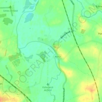
Name: Elford topographic map, elevation, terrain.
Average elevation: 194 ft
Minimum elevation: 148 ft
Maximum elevation: 272 ft
Other topographic maps
Click on a map to view its topography, its elevation and its terrain.
Colton
United Kingdom > England > Lichfield > Colton
Colton, Lichfield, Staffordshire, West Midlands, England, United Kingdom
Average elevation: 295 ft
Chorley
United Kingdom > England > Lichfield > Chorley
Chorley, Lichfield, Staffordshire, West Midlands, England, WS13 8DP, United Kingdom
Average elevation: 469 ft
Fradley Junction
United Kingdom > England > Lichfield
Fradley Junction, Lichfield, Staffordshire, West Midlands, England, DE13 7DN, United Kingdom
Average elevation: 210 ft