
Velká Bíteš topographic map
Interactive map
Click on the map to display elevation.
About this map
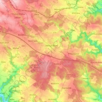
Name: Velká Bíteš topographic map, elevation, terrain.
Average elevation: 1,621 ft
Minimum elevation: 1,184 ft
Maximum elevation: 1,926 ft
Other topographic maps
Click on a map to view its topography, its elevation and its terrain.
Rybníček
Rybníček, okres Havlíčkův Brod, Kraj Vysočina, Czechia
Average elevation: 1,588 ft