Geolocate

Piphema topographic map

Click on the map to display elevation.

About this map

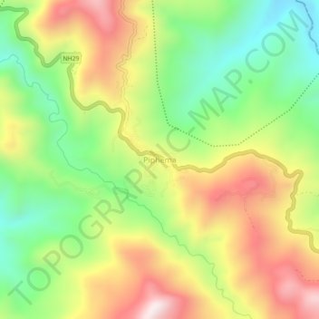
Name: Piphema topographic map, elevation, terrain.

Location: Piphema, Medziphema, Chümoukedima, Nagaland, India (25.73096 93.93940 25.77096 93.97940)

Average elevation: 2,802 ft

Minimum elevation: 1,742 ft

Maximum elevation: 4,068 ft

Gear up for your next adventure:

🔭Stargazing Telescopes - Perfect for camping in low-light pollution areas shown on maps
📦Gear Storage Bags - Organize and protect outdoor equipment
🥾Men's Hiking Boots - Durable, waterproof footwear for rugged terrain and steep inclines
📡Handheld GPS Device - Reliable handheld GPS for outdoor navigation
Backpacking Tent - Lightweight and durable tent for multi‑day hikes

As an Amazon Associate, this site earns from qualifying purchases at no extra cost to you.