
Make a donation
Gear up for your next adventure:
As an Amazon Associate, this site earns from qualifying purchases at no extra cost to you.
Kirchhundem topographic map
Click on the map to display elevation.
Make a donation
Gear up for your next adventure:
As an Amazon Associate, this site earns from qualifying purchases at no extra cost to you.
Kirchhundem
The community of Kirchhundem lies in the Olpe district's southeast in the south Sauerland and belongs to the so-called Bilsteiner Bergland (mountain region). The Kirchhundem rural areas also include, in the east, the West (Rüsper) Rothaar and part of the Auer Ederbergland, in the south the Brachthäuser Hohe Waldberge (all mountain ranges), in the west the Rahrbacher Mulde (basin) and in the north the Hundemgrund. The crest of the Rothaar forms a watershed between the Rhine and the Sieg. The community's highest elevation can be found here, the Hohe Hessel at 743 m. The Kirchhundem area is drained by the Hundem, which rises near Oberhundem and flows northwest to the Lenne. The Hundem is fed from the south by the Heinsberger Bach – also known as the Albaumer Bach (Bach is German for "brook") – whose mouth is near Würdinghausen, the brook variously known as the Brachthauser-, Wirmer- or Flaperbach and the Olpe, whose mouth is in Kirchhundem. The Silberger Bach empties into the Olpe near Heidschott. The Rüspe area east of the Rothaar crest is drained by streams flowing to the Eder.
Make a donation
Gear up for your next adventure:
As an Amazon Associate, this site earns from qualifying purchases at no extra cost to you.
About this map
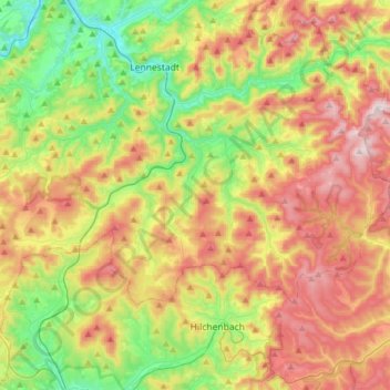
Name: Kirchhundem topographic map, elevation, terrain.
Location: Kirchhundem, Kreis Olpe, North Rhine-Westphalia, 57399, Germany (51.00495 7.93392 51.11480 8.24657)
Average elevation: 1,519 ft
Minimum elevation: 778 ft
Maximum elevation: 2,467 ft
Make a donation
Gear up for your next adventure:
As an Amazon Associate, this site earns from qualifying purchases at no extra cost to you.