
Thank you for supporting this site ❤️
Make a donation
Make a donation
Gear up for your next adventure:
As an Amazon Associate, this site earns from qualifying purchases at no extra cost to you.
Valduga topographic map
Click on the map to display elevation.
Thank you for supporting this site ❤️
Make a donation
Make a donation
Gear up for your next adventure:
As an Amazon Associate, this site earns from qualifying purchases at no extra cost to you.
About this map
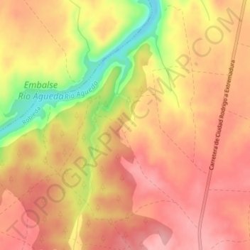
Name: Valduga topographic map, elevation, terrain.
Location: Valduga, Robleda, Salamanca, Castile and León, 37521, Spain (40.39742 -6.62727 40.41742 -6.60727)
Average elevation: 2,654 ft
Minimum elevation: 2,395 ft
Maximum elevation: 2,776 ft
Thank you for supporting this site ❤️
Make a donation
Make a donation
Gear up for your next adventure:
As an Amazon Associate, this site earns from qualifying purchases at no extra cost to you.