
Great Zimbabwe National Monument topographic map
Interactive map
Click on the map to display elevation.
About this map
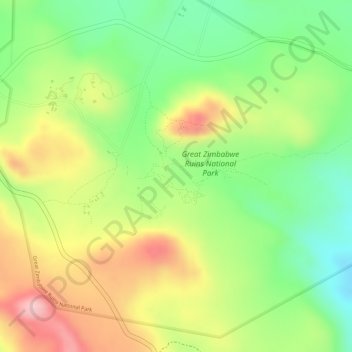
Name: Great Zimbabwe National Monument topographic map, elevation, terrain.
Location: Great Zimbabwe National Monument, Masvingo, Zimbabwe (-20.27099 30.93315 -20.27089 30.93325)
Average elevation: 3,691 ft
Minimum elevation: 3,376 ft
Maximum elevation: 4,029 ft
Other topographic maps
Click on a map to view its topography, its elevation and its terrain.