
Thank you for supporting this site ❤️
Make a donation
Make a donation
Gear up for your next adventure:
As an Amazon Associate, this site earns from qualifying purchases at no extra cost to you.
Dumagbe topographic map
Click on the map to display elevation.
Thank you for supporting this site ❤️
Make a donation
Make a donation
Gear up for your next adventure:
As an Amazon Associate, this site earns from qualifying purchases at no extra cost to you.
About this map
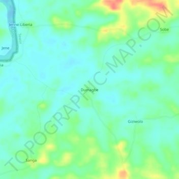
Name: Dumagbe topographic map, elevation, terrain.
Location: Dumagbe, Tewor, Grand Cape Mount County, Liberia (7.05027 -11.33635 7.09027 -11.29635)
Average elevation: 62 ft
Minimum elevation: 13 ft
Maximum elevation: 187 ft
Thank you for supporting this site ❤️
Make a donation
Make a donation
Gear up for your next adventure:
As an Amazon Associate, this site earns from qualifying purchases at no extra cost to you.