Geolocate

Strathgordon topographic map

Click on the map to display elevation.

About this map

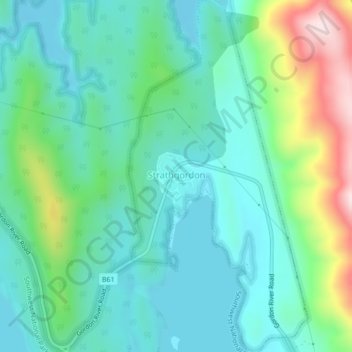
Name: Strathgordon topographic map, elevation, terrain.

Location: Strathgordon, Derwent Valley, Tasmania, 7139, Australia (-42.78255 146.03997 -42.75100 146.06195)

Average elevation: 1,273 ft

Minimum elevation: 965 ft

Maximum elevation: 2,221 ft

Other topographic maps

Click on a map to view its topography, its elevation and its terrain.

Cathedral Mountain

Australia > Tasmania

Average elevation: 3,255 ft

Waterworks Reserve

Australia > Tasmania > Hobart

Average elevation: 787 ft

Rowlands Hill

Australia > Tasmania

Average elevation: 1,273 ft

Cradle Mountain

Australia > Tasmania > Cradle Mountain

Average elevation: 3,753 ft

The Nut

Australia > Tasmania > Stanley

Average elevation: 26 ft

Bream Creek

Australia > Tasmania > Bream Creek

Average elevation: 115 ft

Buxton Point

Australia > Tasmania > Little Swanport

Average elevation: 10 ft

Mount Patrick

Australia > Tasmania

Average elevation: 2,831 ft

Mount Ossa

Australia > Tasmania

Average elevation: 3,996 ft

West Gawler River

Australia > Tasmania > Sprent > Gawler

Average elevation: 659 ft

Mount Tyndall

Australia > Tasmania

Average elevation: 2,986 ft

Gear up for your next adventure:

🗃️Trail First Aid Kit - Essential kit for outdoor injuries and emergencies
🖼️Topo Map Wall Art - Decorative topographic prints of famous peaks and regions
🪶Multi‑Purpose Knife - Useful blade for camp and trail
👖Convertible Hiking Pants - Versatile zip-off pants for changing altitudes and temperatures
🚁Photography Drones - Capture stunning aerial views of landforms and topography

As an Amazon Associate, this site earns from qualifying purchases at no extra cost to you.