Geolocate

Bonnert topographic map

Click on the map to display elevation.

About this map
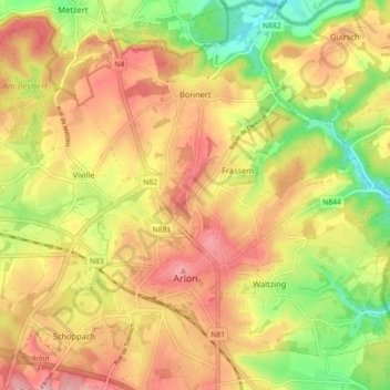
Name: Bonnert topographic map, elevation, terrain.

Location: Bonnert, Arlon, Luxembourg, Wallonia, Belgium (49.67056 5.77793 49.72096 5.86750)

Average elevation: 1,224 ft

Minimum elevation: 961 ft

Maximum elevation: 1,437 ft

Gear up for your next adventure:

🪶Trail Camera - Capture wildlife on your hikes
🦺Reflective Outdoor Gear - Safety gear for low‑light conditions
🧭Orienteering Set - Complete compass and map reading kit
🔭Telescopic Hiking Pole - Adjustable pole for hiking stability
🪶Multi‑Purpose Knife - Useful blade for camp and trail

As an Amazon Associate, this site earns from qualifying purchases at no extra cost to you.