Sector 53 topographic map
Interactive map
Click on the map to display elevation.
About this map
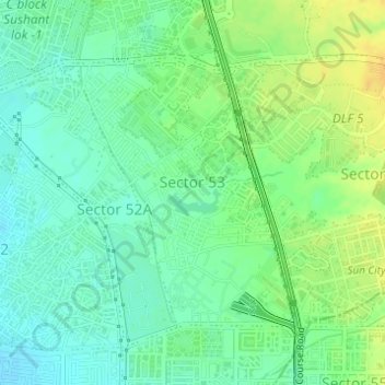
Name: Sector 53 topographic map, elevation, terrain.
Location: Sector 53, Gurgaon, Gurugram, Haryana, India (28.43129 77.08768 28.45025 77.10532)
Average elevation: 810 ft
Minimum elevation: 774 ft
Maximum elevation: 860 ft
Other topographic maps
Click on a map to view its topography, its elevation and its terrain.
Damdama Lake
Damdama Lake, Asola, Sohna, Gurugram, Haryana, India
Average elevation: 794 ft
Sikanderpur
Sikanderpur, Sector 26, Gurgaon, Gurugram, Haryana, India
Average elevation: 823 ft
Najafgarh Jheel
India > Haryana > Gurugram > Daultalbad Village
Najafgarh Jheel, Daultalbad Village, Sector 103, Gurugram, Daultalbad Village, Gurgaon, Haryana, India
Average elevation: 692 ft
Sector 104
Sector 104, Gurgaon, Gurugram, Haryana, 122006, India
Average elevation: 705 ft
Gurgaon One
Gurgaon One, Sector 84, Gurgaon, Gurugram, Haryana, India
Average elevation: 748 ft
Sector 112
Sector 112, Gurgaon, Gurugram, Haryana, India
Average elevation: 702 ft
Cyber City
Cyber City, Sector 25A, Gurugram, Gurgaon, Haryana, India
Average elevation: 801 ft
Sector 108
India > Haryana > Gurugram > Dharampur
Sector 108, Dharampur, Gurugram, Gurgaon, Haryana, India
Average elevation: 696 ft
Gwal Pahari
Gwal Pahari, Sohna, Gurugram, Haryana, India
Average elevation: 830 ft
Chander Nagar
Chander Nagar, Sector 15-II, Gurugram, Haryana, 122001, India
Average elevation: 751 ft
Ambience Island
Ambience Island, Gurugram, Haryana, India
Average elevation: 810 ft