Geolocate

Val-des-Sources topographic map

Click on the map to display elevation.

About this map

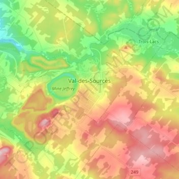
Name: Val-des-Sources topographic map, elevation, terrain.

Location: Val-des-Sources, Les Sources, Quebec, Canada (45.73878 -72.01236 45.80482 -71.87375)

Average elevation: 758 ft

Minimum elevation: 374 ft

Maximum elevation: 1,178 ft

Other topographic maps

Click on a map to view its topography, its elevation and its terrain.

Mont Ham

Canada > Quebec > Les Sources > Ham-Sud

Average elevation: 1,411 ft

Gear up for your next adventure:

🔦Powerful Headlamps - Ultra-bright hands-free lighting for night navigation
🕶️GPS Smartphone Mount - Secure mount for phone navigation
🎒Gear Packing Cubes - Organize your backpack efficiently
🧭Pro Hiking Compasses - High-accuracy liquid-filled compasses for topographic orientation
🎒Hydration Pack - Hands‑free water reservoir for long hikes

As an Amazon Associate, this site earns from qualifying purchases at no extra cost to you.